Sunday, 4 March 2012

Purana Qila

After weeks of visiting the more obscure parts of Delhi, I decided to travel to one of the more well known landmarks of the city. Realizing that it had been 15 years since I last visited the Old Fort, or Purana Qila, I decided that it would make a good choice for the day's excursion. The choice of name is amusing, seeing that it is neither the oldest fort in Delhi nor is it really that much of a military fort. Built as a palace citadel adjacent to the Yamuna flood-plain, it is a popular haunt for Delhiites wanting to take the family boating in the moat surrounding the fort, or as a side-visit for people making a trip to the Delhi Zoo which lies adjacent to the structure.

The significance of the Purana Qila and its surroundings is that the Mughals decided to make this area their first centre of power in Delhi. One of the earliest Mughal structures in Delhi can be seen around here (more on that later). The story of this area begins, historically, with the establishment of his capital, Dinpanah, by Mughal emperor Humayun in 1533 in this area. Later on, in 1540, he lost his empire to Sher Shah Suri, who built a lot of what we see here today, and called his newly refurbished city Shergarh. With Sher Shah's death in 1545, there was a string of quick successions within the Suri dynasty, after which the Mughals under Humayun returned to Delhi. However, Humayun's second reign was to last for less than a year, with him falling to his death down a flight of steps in this citadel's library. A year later, with Humayun's successor Akbar had to contend with a certain Hem Chandra, who was a general under the later Suri kings, wresting control of Delhi, and crowning himself emperor at Purana Qila. A month later, he met a bloody end in a battle with the Mughals. Needless to say, given the extraordinary bad luck that kings have had ruling from here, nobody ever tried to administer Delhi, or the empire, from here again. 

There is a story of how the fort is built on the site of the legendary Mahabharata city of Indraprastha. However, I don't believe that there has ever been any archaeological evidence to substantiate this. The association seems to have been made from the fact that there was a village called Indrapat built within the walls of the fort some time after it was abandoned by the Mughals. Archaeological excavations have pointed to the existence of human settlement here from the Iron Age, based on Painted Grey Ware shards, but the evidence is far from conclusive. A small museum inside the fort does show some of what was unearthed.

Purana Qila is situated on the Mathura road, just north of the Zoo, and just south of Pragati Maidan. There is a fair amount of parking space meant for Zoo visitors. However, I chose to take the metro to Khan Market, and walk the 1.7 km from the station, up Subramaniam Bharti Road to Mathura road. Just at the intersection in front of Purana Qila is another set of buildings which I decided to visit on the way back. Walking up the road to the Purana Qila, one sees the lake on the left (with paddle-boats for hire), and the Zoo on the right. Walking straight ahead, there is a ticket booth (charging Rs 5 for Indians and Rs 100 for foreigners). Access to the archaeological museum requires a second ticket that costs Rs 5 as well.

Compared to earlier forts, particularly those built by the Tughlaqs, you can see that they took the trouble to make the fort look beautiful. Tiled domes, use of sandstone and marble, and elaborate carvings can be seen all over the structure. The fort walls are huge and imposing, and the moat around it would have made unauthorized access difficult. The main entrance into the fort nowadays is the western gate, referred to as the Bada Darwaza. Pegged in between two enormous bastions and high walls, it is an imposing structure. Once inside, the archaeological museum is immediately to the right, built into the fort walls. On its own, it is hardly impressive, but you may as well check it out as part of the overall experience, since there aren't too many things to see here.

Bada Darwaza from the outside

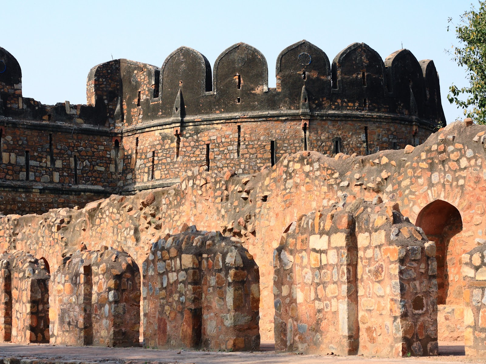
Bastion to the side of the Bada Darwaza

Bada Darwaza from the inside

There are nicely landscaped lawns and gardens all over, making it a nice place for a picnic. Walking to the left, along the walls, I arrived at the northern gate, referred to as the Talaqi Darwaza. Legend has it that Sher Shah Suri went out from here for the Battle of Kalinjar in 1545, instructing that the doors be shut until he retured. Since he died in battle, they never reopened the Talaqi Darwaza.  Something that is apparent here, more than at the Bada Darwaza, is that the gate were built at two levels. The higher level would be used to exit the fort onto land, while the lower level would open out at water level. There is a well-like set of steps taking one down to what would have been the lower level back in the day. The chatris, or canopies, on top of the gate do indicate a more artistic approach to building than previously.

Talaqi Darwaza

Talaqi Darwaza Chatri


Moving on from there, I made my way to the congregational mosque of the fort, the Qila-e-Kuhna Masjid. This was built by Sher Shah in 1541, and is very highly decorated, with marble and sandstone being used as casing material. I would consider this to be the highlight of the entire location.


Qila-e-Kuhna Masjid


Calligraphy on the main gateway

Intricate marble carving

The sheer quality of the artwork is impressive


From there, I moved southwards to the other major building in the fort, the Sher Mandal. There is some uncertainty regarding who actually built the Sher Mandal,  and the official ASI info-box evades the question. It is built on the highest point in the fort and was probably used as both an observatory and library. It is a two-level octagonal structure, which one can no longer climb. Humayun died here in 1556 when he tripped and fell while coming down the stairs while rushing to his prayers. Along the way I passed a narrow stepwell, or Baoli, and a brick structure that is claimed to be the remains of heated baths, or Hammams.


Baoli, with Qila-e-Kuhna Masjid in the background

Hammams

Sher Mandal

Balcony at Sher Mandal
Finally, I continued southwards down the road to arrive at Humayun Darwaza. This is where the two-level gateway mentioned earlier is most apparent. And that was it as far as Purana Qila was concerned. There is a sound and light show held here every evening except on Mondays, describing the story of Delhi's seven cities and how it evolved to the place it is today. The actual start time for the English-language show varies depending on the season, ranging from 7:30 pm to 9 pm and lasting an hour. Tickets cost Rs 80 on weekends and are a little cheaper on other days. 


Humayun Darwaza - the two-level entrance is clearly visible


On my way back to the metro station, I decided to visit two buildings across the road. The first is the Khairul Manzil, a buiilding that functioned as both a mosque and a madrasa in the past. This was built by Maham Anga, the 'wet-nurse' of Mughal emperor Akbar and generally wily proxy ruler for a while, in 1561. The name literally translates to 'auspicious house'. It's a bit forlorn today, but there is a kindly old caretaker who is keen to share his knowledge of the place with you. It appears that the mosque is still in use, if sparingly so.


Khairul Manzil Courtyard

Entrance gate and water tank

Intricate paintings on the inside of the mosque


Adjacent to this building is the Lal Darwaza, also known as Sher Shah Gate, once the southern entrance to Sher Shah's capital city of Shergarh. Lining the road to the gate are the remains of what were probably shops. While photographing, a security guard who was snoozing under the gate woke up, embarrassed at having been caught sleeping, and told me that I was not allowed in. I pointed out that I wasn't the only person around, and that the gate was open, with big ASI boards all around. I asked if he had a copy of the order closing the gate to the public, and he walked away mumbling something to himself, allowing me to continue my photography. Checking the Lal Darwaza off the list, I finally made my way back to the metro station, and then home.


Lal Darwaza or Sher Shah Gate

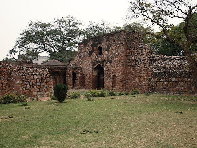
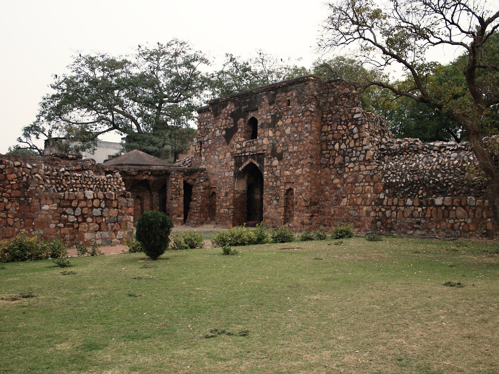
Part of the walls of Shergarh, with ruins of shops in the foreground


Here is a map of the places visited:


View Purana Qila in a larger map

Monday, 20 February 2012

Urban Mehrauli - the Original Old Delhi

A Sunday afternoon stroll in Mehrauli is probably not everyone's idea of fun. Mehrauli is the very embodiment of urban chaos. Narrow streets and by-lanes with cars and bikes jostling for space with people, animals and rickshaws make for a perfect mess at the best of times. However, peppered all over the place are buildings from the past, obscured by electricity wires and modern high-density accommodation. It takes some work to find one's way through Mehrauli, but patience does pay off in the end, revealing architectural pieces that one would never expect to find there.

I had visited the Mehrauli Archaeological Park earlier in the year, and the sites on today's trip would have been contemporaneous to so much of what exists in the Park. Today's vist was to be a selection of buildings spanning the Lodhi and Mughal periods. None of the buildings I on this trip are ticketed and are, therefore, quite likely to be occupied by local children playing cricket.  I decided to walk from the Qutub Minar metro station to save myself the intense pain that would accompany driving in Mehrauli. Walking north along the Mehrauli-Gurgaon road, there is a small road to the left around 100 metres beyond the metro station. Taking this road, and walking down about 200 metres, I came to the Madhi Masjid on my left.


It isn't easy to learn about this lovely mosque. The internet is not forthcoming with information, and the ASI has not deemed it important enough to provide their customary info-block. About all I was able to learn was that it is a Lodhi-era mosque (which would date it to the 15th-16th century). There's not a soul in sight over here, barring the security guard, making this a great place for photos, or to just lose oneself. There is a huge and ornate gate just at the entrance to the compound, with a flight of steps leading up to it.  As one climbs up, one walks into the courtyard of the mosque, with a couple of tombs in the centre. At the western end of the courtyard is a walled enclosure with a mihrab pointing towards Makkah. The clover-shaped embellishments running along the upper ridge of the wall and the entrance gate confirm the mosque's Lodhi origin. There is some lovely blue-tile work along the wall enclosure, and detailed calligraphy to complement it. It's possible to climb up to the top of the mosque by staircases along the sides. It affords a beautiful view of the surrounding forest.


Entrance Gate to Madhi Masjid
Madhi Masjid from the outside - beautiful serenity
The inner courtyard of the Madhi Masjid
A closer look at the detailing on the walls
The view from the top


From the Madhi Masjid, I continued walking up the road, past a Jain temple. This part of Mehrauli is a low hill, and the incline is quite noticeable. Following the natural course of the road (and avoiding the roads branching off to the sides), I ended up at the Zafar Mahal, a later Mughal summer palace. It is easy to get lost on the way, but the locals are helpful enough to direct you to the place. 


Now, Zafar (Victory), was the nom de plume of Bahadur Shah II, the last Mughal king. However, the building itself was constructed by Akbar Shah II, his father, and was probably called the Lal Mahal at the time. The choice of location, atop the hill, would have made for a lovely view back in the day. However, more significantly, it is adjacent to the dargah of Qutubuddin Bakhtiar Kaki, one of the most famous Sufi saints of the time. Several of the later Mughals are buried here, and the grave-site is quite cluttered. Bahadur Shah II himself planned to be buried here, but the events of 1857 would see him exiled to Burma, where he lived out the rest of his days.


The most impressive part of the building today is the massive red sandstone and marble entrance gate, something of a cross between the Naubat Khana and Chatta Chowk that one sees at the Red Fort. Most of the rest of the palace is in ruins, though it is possible to climb up to the top of the gate, and even visit the adjoining Moti Masjid, used by the royals for personal prayer.


Entrance to Zafar Mahal
Intricate craftsmanship on entrance gateway
Ruined interiors of Zafar Mahal
Upper floor pavillion with pillars
Moti Masjid and Dargah of Qutubuddin Bakhtiar Kaki in the background
View from the windows today


A visit to the adjacent Dargah would have been a very reasonable addition to the itinerary, but I was a little short of time, and decided to press on. Continuing up the road towards the Mehrauli bus terminus, I ended up at the Tomb of Adham Khan. 


Adham Khan was one of Mughal emperor Akbar's generals and a 'foster brother' of sorts. He and his mother, Maham Anga, were not too pleased with the position and favours bestowed on a certain Ataga Khan, another of Akbar's 'foster' brothers. They decided to do away with Ataga Khan, and killed him at Agra fort. Akbar was, understandably, enraged by this, and ordered Adham Khan killed by throwing from the walls of Agra fort (he went through it a second time, since he survived the first fall). With that, he was buried here, on what is apparently part of the wall of the Tomar period Lal Kot. As a side note, Adham Khan was the brother of Quli Khan, who's tomb, the Dilkusha of Metcalfe, is part of the Mehrauli Archaeological Park. Small world.


The tomb is an octagonal structure with a labyrinth on the lower level, because of which the locals refer to the place as the Bhoolbhulaya or place of forgetting. It isn't the most impressive of monuments, but it is quite large for the tomb of a nobleman. I suppose it would be more interesting if they let one wander through the labyrinth.


Octagonal tomb of Adham Khan
The most noticeable feature of the tomb is the artwork on the inside of the dome
The Qutub Minar, as seen from Adham Khan's tomb


For those inclined, there is a little lane behind the Mehrauli bus terminus that takes one to the Gandhak-ki-Baoli (bulit during Iltutmish's time in the 1200s, and is quite dry now). However, I decided to move on. From there, I walked to the Qutub Minar, and caught a shuttle minibus to the Qutub Minar metro station. Taking the metro to the next stop at Chattarpur, I walked back into the south end of Mehrauli at Andheria Mode, around 250 metres away. From there, I walked up the Mehrauli market road for about 600 metres till I arrived at the Hauz-i-Shamsi and adjacent Jahaz Mahal.


The Hauz-i-Shamsi was a Mamluk-era water tank built by Iltutmish, after he saw a dream in which Muhammed asks him to build a tank here. The fact that Qutubuddin Bakhtiar Kaki saw the same dream only seemed to confirm to Iltutmish the necessity of constructing this structure. On the other side of the tank, there is a pavillion to mark the spot where they believed the hoof-print of Muhammed's horse was found. Today, the pavilion is off-limits, locked behind an iron gate. This tank was the primary water source for Mamluk-era Mehrauli.


On the market-side of the tank, the Lodhi-era Jahaz Mahal emerges out of nowhere. It was probably used as an inn by travellers and pilgrims who were visiting the tombs of Sufi saints in the city, though there seems to also be a theory of this place being used as a summer retreat by royals. The building gets its name from the fact that it is built on what was then the bank of the Hauz-i-Shamsi, making it look (you have to be very imaginative here) like a ship on the water's edge. Today the tank is much smaller than it once was, and the Jahaz Mahal is a good 20 metres from the water's edge. The building is constructed on two levels, and the the arches and cupolas do catch the eye.


Jahaz Mahal from the road
Entrance to Jahaz Mahal
Inner courtyard of Jahaz Mahal
Iltutmish's pavillion with the Jahaz Mahal across the Hauz-i-Shamsi


The Mehrauli area has so many other places of interest, and it would take a significant amount of time to cover everything in detail. People often just visit the Qutub Minar and don't see beyond it, not realizing just how much history is lurking around the corner. What is impressive is how there are pockets of tranquility so close to the bustle of the marketplace, with the opportunity to appreciate history thrown into the bargain.


Here is a map of places on the visit:


View Urban Mehrauli in a larger map

Sunday, 12 February 2012

Ferozabad's Heart

That Feroz Shah Tughlaq was an obsessive builder has been mentioned before. On the visit to Hauz Khas, I did come across a fair amount of his handiwork. Believing in a 'shock-and-awe' strategy with respect to public buildings, it wasn't long before he decided that the existing forts and population centres in Delhi (Mehrauli, Siri, Tughlaqabad and Jahanpanah) were inadequate for his ambitions. To that end, he decided to create his own capital on the banks of the Yamuna, in what he called Ferozabad. Within this was his palace complex built as a citadel that we know today as Feroz Shah Kotla (but which was called the Kushk-e-Feroz when it was built), which was the focus for this outing.

Now for a brief bio on the man. Regarded as the last of the more significant Tughlaqs, he ruled the Delhi Sultanate between 1351 and 1388, succeeding his cousin, Mohammed bin Tughlaq. It was a time of turmoil when he took over, and parts of the Sultanate were breaking away. Rather than risk protracted war, he chose to stabilize and administer a smaller realm. Now, Feroz Shah was no saint. Based on measures like the jaziya tax on non-Muslims and more direct conversion requests/orders, he was probably not the most fondly regarded of rulers. But, it seems that he did initiate significant building projects, including canals, madrasas and a rudimentary unani-based hospital system. He lowered land revenue taxes that were raised by his predecessor. Together with his prime minister Khan-e-Jahan Maqbul Tilangani, he ensured efficient and peaceful administration of the Sultanate.

To most Delhiites, and most other Indians, Feroz Shah Kotla is associated with cricket, courtesy the stadium built on land abutting the citadel. It's probably fair to say that most cricket fans visiting the stadium have never ventured inside the actual Kotla. I was amused to see that the Wikipedia article on the place (as of today) is a mixed-up narrative that can't decide whether to be about the stadium or the citadel. I guess I should try editing the article, when I get the chance. 

Feroz Shah Kotla is located on Bahadur Shah Zafar marg, a leisurely 1.5km walk up north from the Pragati Maidan metro station. Walking north, past the offices of several major and minor newspapers, one comes to a gated park called Shaheed Park. Just beyond it, on the right, is a lane leading to the citadel. The monument is ticketed, with entry at Rs 5 for Indians (and SAARC, Myanmar, Thailand nationals) and Rs 100 for others. As with other ASI monuments, one can enter between 10 am and 5 pm. Based on what I saw, it is possible to park on the lane, though there is also a paid parking just before Shaheed Park, for those who prefer to drive in.

Right off the bat, it is apparent that the citadel is Tughlaq. The characteristics of Tughlaq architecture are everywhere - rough stones set in mortar and large, sloping walls are everywhere. From a location perspective, the citadel was built on the banks of the Yamuna back in the day, but the river itself has shifted course in the last century or so, leaving a road and sporting facilities where the river once flowed. Ferozabad marks the first time in Delhi that a major city was being constructed on the banks of the river. Given the water problems of the previous fortifications, it seems surprising that nobody thought of building a city near such an abundant source of water earlier (given that it was much cleaner back then than it is today).

Wall of Feroz Shah Kotla with circular bastion - note the arrow slits and sloping walls

Walking through the gate, there are ruins of buildings on either side, along with the obligatory ASI blurb on the place. There's a convenient map that identifies a Baoli (step-well), the Ashokan Pillar, a Mosque and the ruins of the Palace within the citadel, which I used to work my way through the place. The sheer number of green parrots and doves here (along with the more common crows and pigeons) is stunning. There is, of course, plenty of grain strewn around by people, making it a very attractive place for the birds.


Parrot in flight (this is at the western end of the citadel, but the birds are everywhere)

Walking to the left, there is a pathway leading straight to the Baoli. Unlike most other Baolis in Delhi, this one is circular, and isn't really a step-well. Right now, it's fenced off and the best that one can do is peer at it through the iron bars. It seems that this functioned more like a normal well, with a pulley system to get water into channels that distributed it. There are the ruins of a canopy which once covered the well. I imagine it must have been quite picturesque back in the day.

Circular Baoli - behind the iron curtain


Moving on from there, one immediately sees a pyramidal structure atop which is a broken Ashokan pillar. This pillar (initially carved around 250 BC) was brought here from near Ambala, and I gather that the pyramidal structure (consisting of inter-connected chambers on 3 levels) was designed specifically to showcase the pillar. It is possible to climb to the top of the pyramidal structure via an entrance on the western end (the rear, for all practical purposes), though there are a few very large dogs to contend with on the way around and up the structure. Once there one can see just how well turned out the pillar is.  It has a highly polished finish and inscriptions in both the Brahmi script (the original Ashokan Pali edicts) and the more recent Kutila script (a precursor to modern Devanagari). A copper dome sat atop the pillar, but it was taken away during either the Maratha or Jat raids on Delhi in the 1700s.

Ashokan Pillar atop the pyramid
Arches inside the pyramid
A view of the Ashokan pillar from the rear

If you look around the lower level of the pyramid, you will find coloured strings, letters and flower offerings to djinns that are supposed to inhabit the place, asking for favours. I'm not sure of the story behind the practice, or of why this place is special, but the locals (both Muslim and Hindu) do believe that wishes are granted. 

Offerings and petitions to the djinns


To the rear of the pillar and pyramid is a lovely square pavillion with concentric rings of pillars, but to appreciate it best, one should see it from the adjoining Jami Masjid. This is a well proportioned mosque that apparently impressed Timur the lame so much (while he was busy looting and pillaging) that he had artisans from his native Samarkand come in to copy the design for replication in his homeland. It was the largest of the 6 or 7 mosques built during Feroz Shah Tughlaq's reign. The mosque does have its share of intrigue as well, being the place where the Mughal king Alamgir II was murdered by his prime minister Imad-ul-Mulk in 1759. Since this is a functioning mosque, shoes do need to be removed at the entrance. Also, it's important to be respectful to the congregation during prayer times. 

Ruins of the Jami Masjid
Entrance Archway to the Jami Masjid
Square pavillion to the rear of the pillar and the mosque - concentric rings of pillars


Finally, walking back along the southern edge, I came to the ruins of the palace area. Theoretically, these are separated into private apartments and audience halls. Given the state of ruin, I wasn't sure which was which, though it stands to reason that matters of state couldn't have happened too far from the main entrance, leaving the rest to be living quarters. All the same, the outline of the building gives an idea of its size and grandeur. It makes for a compelling walk, where one can take in the sight of the birds, trees and ruins as one goes along.

A solitary banyan tree in the south-eastern part of the palace area
South gate of Feroz Shah Kotla

And that's it. I was back, full circle, to the entrance gate, having walked past a medley of ruins in an advanced state of decay. On the way out, it's worth one's while to pop across to the median in the road and take a look at the Khooni Darwaza. This is of a more recent vintage than Ferozabad, and was probably the northern extremity of Sher Shah Suri's Shergarh city. The ASI would like us to believe that it was Shergarh's Kabuli Darwaza, showing the way to Kabul, but it's difficult to reconcile it with the theory that Shergarh's city walls probably never extended this far north. The archway's claim to fame is that this is the place where the Mughal dynasty came to an end. In the aftermath of the events of 1857, Bahadur Shah Zafar's sons and grandson were brought back to Delhi and executed at this spot, with their bodies displayed here for days afterwards, giving the gate it's popular name. That's something to chew on.

North face of the Khooni Darwaza - imagine bodies dangling from the top
South face of the Khooni Darwaza


Here is a map of the places visited and the route from the Metro station:


View Feroz Shah Kotla in a larger map